Mountain Ranges of Himachal Pradesh: Peaks, Valleys, Elevations, Snowfall and Stories
Namaste. My name is Shiv Kumar. I was born and raised right here in the mountain ranges of Himachal Pradesh. These mountains are not just geography for me. They are home, memory, and the living stories my grandfather told near the winter fire. Today I will walk you through every major range – the Shivalik Range, Dhauladhar Range, Pir Panjal Range, Great Himalayas and Zanskar Range – with their exact elevations, history of names, snowfall patterns, rainfall, road access, famous peaks and practical advice. Whether you are planning a trip to Dharamshala, Manali, Spiti or Kinnaur, this complete guide will help you understand the land like a local.
From the gentle Shivalik foothills around Nahan to Reo Purgyil, the highest peak in Himachal Pradesh at 6,816 metres in Kinnaur, the land rises step by step. The Dhauladhar Range stands like a white wall above the green Kangra Valley. The Beas river cuts through the Kullu and Manali valley under the Pir Panjal. Then the high peaks give way to the cold desert of Spiti in the Zanskar Range. Knowing which mountain range you are looking at explains why a morning in Dharamshala feels completely different from an evening in Kaza.
Mountain Ranges of Himachal Pradesh at a Glance – Elevations and Road Access
These elevation figures show the broad belts. The mountains blend into each other. In the Lesser Himalayas the Pir Panjal still holds peaks above 6,200 metres.
| Mountain Range | Elevation in Himachal Pradesh | Famous Landmark / Highest Peak | Road Access Status |
|---|---|---|---|
| Shivalik Range (Outer Himalayas) | 350 – 1,500 m (some ridges up to 2,000 m) | Nahan 932 m | Excellent all-year roads |
| Lesser Himalayas – Dhauladhar Range | 1,500 – 5,900 m | Indrahar Pass 4,342 m, Hanuman Tibba ~5,900 m | Valley roads open year-round, high trails seasonal |
| Lesser Himalayas – Pir Panjal Range | 1,500 – 6,221 m | Rohtang Pass 3,978 m, Indrasan 6,221 m, Deo Tibba 6,001 m | Manali road excellent, Rohtang seasonal, Atal Tunnel all-weather |
| Great Himalayas (Himadri) | Above 4,500 m, many peaks over 6,000 m | Kinner Kailash ~6,050 m | Valley roads good, high passes and trails seasonal |
| Zanskar Range | 3,930 m (Shipki La) to 6,816 m | Reo Purgyil 6,816 m – highest peak in Himachal Pradesh | Limited, high roads closed in heavy winter snow |
Shivalik Range Himachal Pradesh – The Southern Foothills
The Shivalik Range, also called Outer Himalayas or Shiwalik Hills, is the first mountain range you meet when entering Himachal Pradesh from the plains. The name “Shivalik” comes from Sanskrit meaning “belonging to Shiva” or “the tresses of Lord Shiva.” In ancient times people also called them Upgiri. Geologically these are the youngest Himalayan hills, formed from soft sand, silt and gravel brought down by rivers. That is why the Shivalik Range erodes easily and looks gentler than the ranges behind it.
Looking for a Hotel? Check Agoda Double Day Sale!

In Himachal the Shivalik Range covers Una, Hamirpur and Bilaspur completely, plus the lower parts of Kangra, Solan and Sirmaur. Elevation mostly stays between 350 and 1,500 metres. Nahan at 932 metres is a perfect base to experience these foothills.
Snowfall and Rainfall in Shivalik Range: This is a subtropical zone. Monsoon rainfall is good – usually 1,000 to 2,000 mm in a year. Summers can be hot. Winters are mild. Snow almost never falls in the lower Shivalik hills. Only the highest ridges see a light dusting on very cold years.
Road Access: Excellent. National highways and state roads stay open all year. You can drive comfortably even in monsoon, though landslides can occur after heavy rain on some stretches.
Come to Nahan and pair a walk through the old town with a visit to Renuka Lake. The soft light and green ridges of the Shivalik Range make a gentle introduction before the real mountains begin.
Dhauladhar Range – The White Wall Above Kangra Valley
The Dhauladhar Range is part of the Lesser Himalayas. The name Dhauladhar means “White Range” or “White Ridge” in the local language – because for many months the peaks shine white with snow when seen from the Kangra Valley. It rises almost like a steep wall behind Dharamshala and McLeod Ganj.
Elevation in the Dhauladhar Range commonly runs from 3,500 m to nearly 6,000 m. Hanuman Tibba is one of the highest peaks. Indrahar Pass at 4,342 metres is the classic trek from Dharamshala side towards Chamba. Peaks in the Ravi basin section often stand between 4,300 and 5,200 metres.
Snowfall and Rainfall in Dhauladhar: The southern slopes facing the Kangra Valley receive some of the highest rainfall in Himachal Pradesh – often more than 2,500–3,000 mm in a year. That is why Dharamshala and Palampur stay so green. Higher elevations receive heavy winter snowfall. The northern slopes sit in the rain shadow and are drier.
Road Access: Roads to Dharamshala, McLeod Ganj and Palampur are excellent and open year-round. High trekking routes across Indrahar Pass are seasonal – best from late spring to early autumn. Heavy snow closes the high trails in winter.
Base yourself in Dharamshala or McLeod Ganj for mountain views and Tibetan Buddhist sites such as the Tsuglagkhang Complex. Visit Palampur for tea gardens under the same Dhauladhar Range, or explore the historic Kangra Fort. The contrast between the green valley floor and the white Dhauladhar wall is unforgettable.
Pir Panjal Range and the Kullu-Manali Valley
The Pir Panjal Range is the longest range of the Lesser Himalayas. The name has old roots. Historical records mention “Panchaladeva” – the deity of Panchala. Over time the word “Pir” (saint) became part of the name, and it became Pir Panjal. In Himachal it forms the high wall above the upper Beas valley and continues into Kashmir.
Key elevations: Rohtang Pass sits at 3,978 metres. Indrasan rises to 6,221 metres on the main crest. Deo Tibba stands at 6,001 metres and is locally called the “Hill of the Gods.” The Kullu Valley follows the Beas river, with Manali higher up the valley.
Snowfall and Rainfall in Pir Panjal: Southern and eastern faces receive good monsoon rain. Higher elevations see heavy winter snowfall. Rohtang Pass and the peaks above stay under deep snow for many months. Glaciers still feed the upper Beas system.
Road Access: The road to Manali is excellent. Rohtang Pass is usually open from late May or early June until around mid-November, depending on snowfall. Vehicle permits are required. The Atal Tunnel now provides an all-weather alternative under Rohtang, keeping Lahaul accessible even when the pass is closed. High trekking routes remain seasonal.
Stay in Manali for Beas Valley views, Solang Valley and easy access towards Rohtang. The mountains feel close here. Many visitors come for a few days and end up staying longer.
Great Himalayas (Himadri) in Himachal Pradesh
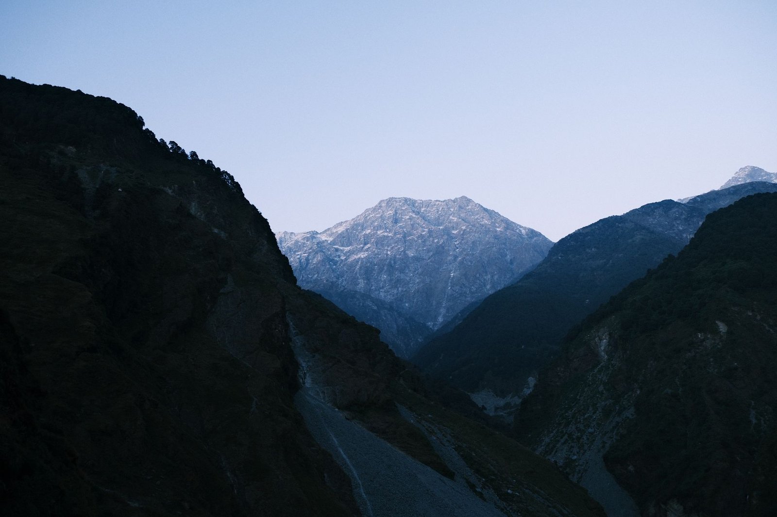
Above roughly 4,500 metres we enter the Great Himalayas, also called Himadri or Greater Himalayas. The name Himadri means “abode of snow.” This is the high continuous wall of the main Himalayan system. In Himachal it runs through parts of Chamba, Kullu, Lahaul-Spiti and Kinnaur. Permanent snow and glaciers dominate the highest ridges. Many peaks cross 6,000 metres.
In Kullu district the Great Himalayan National Park (a UNESCO World Heritage Site) protects forested river valleys, alpine meadows and glacial headwaters of rivers that feed the Beas. Tirthan and Sainj valleys are excellent places to experience the forested side of the Great Himalayas. Hanskund Peak at around 4,800 metres is considered the source area of the Tirthan River. In Kinnaur, Kalpa looks directly at sacred Kinner Kailash (about 6,050 metres). Sangla sits beside the Baspa River under steep snowy slopes.
Snowfall and Rainfall: Outer faces still receive monsoon moisture. Higher up, most precipitation falls as snow. Above 4,500–5,000 metres many areas remain under permanent snow and ice. Winters are long and severe.
Road Access: Valley roads into the Great Himalayan National Park area are good in the main season. High alpine trails and passes are strictly seasonal. In Kinnaur the Hindustan-Tibet Road provides the main artery, but side valleys close with heavy snow.
Zanskar Range – Reo Purgyil and the Cold Desert of Kinnaur & Spiti
The Zanskar Range (also spelled Zaskar on older maps) meets the Greater Himalayas around the Sutlej, Spiti and Baspa valleys. The name is linked to the Tibetan word for copper. This is true high-altitude cold desert. The landscape opens up, colours become muted, and the silence feels different.
Reo Purgyil at 6,816 metres is the highest peak in Himachal Pradesh. Local Kinnauri and Spitian people call it Reo Purgyil. Early British surveyors mixed the name with the nearby village of Leo and wrote “Leo Pargial” on maps – an error that lasted for decades. Shipki La at 3,930 metres is a historic border pass that was once an important Indo-Tibetan trade route.
Nako village at about 3,663 metres offers a quiet stop with a willow-fringed lake and small Buddhist temples. From Kaza you can visit Key Monastery and Kibber. Tabo Monastery is famous for its ancient murals and stucco sculptures.
Snowfall and Rainfall in Zanskar / Spiti: This is cold-desert climate. Annual precipitation is very low – often under 200–500 mm – and most of it falls as snow in winter. High peaks remain under permanent snow and ice. Summers can be bright and dry; winters are extremely cold and long.
Road Access: Main roads through Kinnaur and into Spiti are open only in the warmer months. Heavy snowfall closes high sections for many months. Always check current road status, carry spare fuel, warm clothing and emergency supplies. Inner Line Permits are required in many border areas.
Climate Zones of Himachal Mountain Ranges – Why Kangra is Greener than Spiti
Elevation and the direction a slope faces decide the climate. Western and southern slopes facing the Dhauladhar catch heavy monsoon rain. The high country near Tibet stays dry because the mountains block moisture.
- Subtropical foothills (350–1,000 m) – Warmer, more humid. Good monsoon rain (1,000–2,000 mm). Almost no snow. Example: Nahan and lower Shivalik towns.
- Temperate middle hills (1,000–2,500 m) – Pleasant summers, cold winters with snow at higher ends. McLeod Ganj at about 2,082 m is a classic example.
- Alpine and glacial high country – Forest gives way to alpine meadows, then snowfields and glaciers. Visible clearly inside the Great Himalayan National Park.
- Trans-Himalayan cold desert – Spiti and upper Kinnaur. Very low rainfall, heavy winter snow, extreme cold. Cold Desert Biosphere Reserve spans roughly 3,300–6,600 m.
Popular Hill Stations in the Mountain Ranges of Himachal Pradesh
- Shimla and Kufri – Classic Ridge and Mall Road experience. Kufri adds a higher hill station feel.
- Manali – Upper Beas Valley, Solang Valley, and access towards Rohtang Pass and Pir Panjal.
- Dharamshala, McLeod Ganj and Palampur – Best for Dhauladhar views, Tibetan monasteries and Kangra tea gardens.
- Dalhousie and Khajjiar – Forest walks and the famous meadow of Khajjiar ringed by pine and deodar.
- Kasauli – Quieter break with wooded trails such as the Gilbert Trail.
For a first trip I usually suggest Dharamshala–Palampur for the contrast of tea gardens and Dhauladhar, or Kullu–Manali for the river valley and Pir Panjal access. If you plan Lahaul or Spiti, always check weather and road advisories, especially around Kunzum Pass (4,551 m).
Frequently Asked Questions (FAQ) about Mountain Ranges of Himachal Pradesh
Which is the highest peak in Himachal Pradesh?
Reo Purgyil at 6,816 metres in the Zanskar Range of Kinnaur is the highest peak in Himachal Pradesh.
What is the elevation of Rohtang Pass?
Rohtang Pass sits at 3,978 metres on the Pir Panjal Range and connects Manali to Lahaul.
How much snowfall does Dharamshala and Dhauladhar receive?
Lower Dharamshala gets heavy monsoon rain and occasional winter snow. Higher Dhauladhar peaks receive substantial winter snowfall and stay white for many months.
Is the road to Spiti and Kinnaur open all year?
No. High roads through Kinnaur and over Kunzum Pass into Spiti are seasonal and usually close with heavy winter snowfall. Always check current status before travel.
What is the best time to visit the mountain ranges of Himachal?
March to June for pleasant weather and open roads in most areas. July–September for monsoon greenery (with landslide risk). October–November for clear views and autumn colours. December–February for snow, but many high roads and passes remain closed.
How did the Dhauladhar Range get its name?
Dhauladhar means “White Range.” The peaks appear white with snow for a large part of the year when viewed from the Kangra Valley.
Can I drive to Rohtang Pass?
Yes, during the open season (usually late May to mid-November) with a required vehicle permit. The Atal Tunnel provides an all-weather alternative to reach Lahaul.
These mountain ranges of Himachal Pradesh – Shivalik, Dhauladhar, Pir Panjal, Great Himalayas and Zanskar – are not just geography. They are home, memory, and living teachers. Come with open eyes and a quiet heart, and they will speak to you too.
— Shiv Kumar
Himachal Pradesh
हिमाचल यात्रा प्लान करने से पहले ये फ्री टूल्स जरूर इस्तेमाल करें:
- Himachal Best Time to Visit Calculator
- Himachal Trip Budget Calculator
- Himachal Trip Fuel Calculator
- Himachal Weather Live Forecast
Important Tips for All Travellers
- Check the latest Official HP Travel Advisory before your journey.
- Read our complete Tourist Visa Guide if you are a foreign traveler.
- Keep Himachal Clean & Green – Please carry your waste back and respect the local culture & environment.
For Foreign Travellers – Free Personalized Help
Want to experience authentic village life, local culture, and genuine Himachali hospitality? We can help you curate a personalized trip at the best genuine rates.
- Free trip planning & quotation in your currency
- Priority booking in Himachal Government Rest Houses
- BMC certified local guides (city-wise)
- Best rates on bike, auto & car rentals from government-approved agencies
- Free local Himachali handicraft gift for all foreign travellers
Please get in touch with us for a free personalized quotation.
हिमाचल में बेस्ट होटल खोज रहे हैं?
चाहे आप Manali, Shimla, Kasol, Kullu, Spiti Valley, Kinnaur, Chamba, Dharamshala, McLeod Ganj, Dalhousie, Kasauli या हिमाचल के किसी भी अन्य destination की यात्रा प्लान कर रहे हों — सही होटल सही कीमत पर मिलना बहुत जरूरी है। Agoda पर आप हिमाचल के होटल्स की लेटेस्ट कीमतें, असली गेस्ट रिव्यूज और बेस्ट डील्स आसानी से चेक कर सकते हैं। बहुत से यात्री Agoda को इसलिए पसंद करते हैं क्योंकि यहाँ अक्सर बेहतर डिस्काउंट और फ्लेक्सिबल बुकिंग ऑप्शन मिलते हैं।